
Old Hampshire Mapped
Milne's Hampshire 1791


The map title is half way down on the right:-
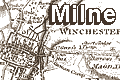
HAMPSHIRE, / or the / County of Southampton, / including the / ISLE OF WIGHT. / Surveyed by Thos. Milne in the years 1788, 89 & 90 / executed and Published / at the private expense of the Proprietor / W. FADEN, / Geographer to His MAJESTY, / Charing Cross Decr. 20th. 1791.The map includes town plans of Winchester and Southampton.
The copy used has the six sheet map dissected into 48 pieces, sectioned and mounted on a single textile (linen?) backing, folded in a slip case. The unfolded overall size is 143x148.5cm.
The map has a scale line, 5 miles = 124.9mm, giving a declared scale 1 to 64425, 1.01 inch to 1 mile, assuming a modern mile, or more realistically:-
1 to 1 to 64000The scale can be estimated from town positions, comparing to known town-town distances using DISTAB.exe. The map scale is about:-
1 inch to 1 mile
1 to 1 to 63000This map is not the first one inch map of the county; Isaac Taylor produced one in 1759.
1 inch to 1 mile
Although this map is an important source of information, useful when interpretting the contents of other maps, there is no intention to analyse this map at the present stage of the Old Hampshire Mapped project; it falls outside the main focus of the project which is on single sheet county maps.
Map HMCMS:FA1998.124
